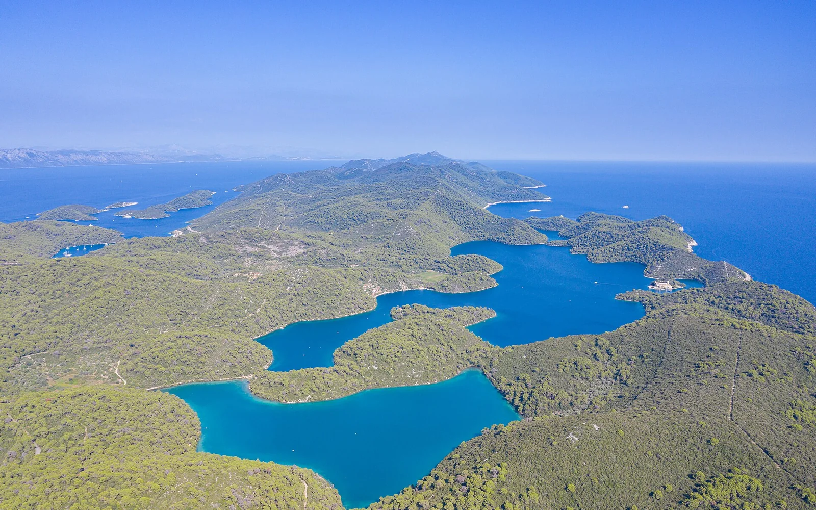
Mljet Island and Mljet National Park are not the same place. The protected park occupies the western part of the island around the saltwater lakes, while Sobra, Saplunara and other settlements lie outside it.
Start with what makes Mljet Island distinct
Mljet Island and Mljet National Park are not the same place. The protected park occupies the western part of the island around the saltwater lakes, while Sobra, Saplunara and other settlements lie outside it.
Sobra to Pomena is roughly 35 kilometres by road. Choose Pomena or Polače for park access, Sobra for a central port connection, or the east for quieter beaches. Changing base can make sense on a four or five-day stay.
The national park
The park centres on Veliko and Malo Jezero, with walking, cycling and authorised boat services. Admission, boat operation and access points change by season, so use the official park information.
Central and eastern Mljet
Sobra is an important arrival port rather than the island’s main sightseeing centre. Saplunara and eastern coves offer a different beach-focused stay far from the park.
Distances and roads around Mljet Island
The main island road is narrow and winding in places. Repeated trips between the western park and eastern beaches use more time than the island’s map shape suggests.
Build a realistic visit to Mljet Island
Day 1: arrive at the correct port and settle into the chosen base.
Day 2: explore the park lakes on foot or by bicycle using current official routes.
Day 3: add Polače, Pomena and one authorised boat connection.
Days 4 to 5: move east or central for villages and beaches outside the park.
Arrive and move around Mljet Island
Passenger catamarans and vehicle ferries use different Mljet ports on seasonal schedules. Sobra is a key vehicle-ferry port, while Pomena or Polače receive selected passenger services. Confirm the exact port and onward transfer.
Island buses are limited and may be timed around local needs or ferries. Bicycles work well inside the park but not for every cross-island journey. A car improves flexibility, though roads and parking are constrained.
Food and local stops in Mljet Island
Look for fresh fish, octopus, goat dishes, local olive oil and simple island cooking. Restaurant choice is concentrated in the main settlements and reduces outside summer.
Choose the right conditions for Mljet Island
Late spring and September suit cycling and walking. Summer has more sailings and services but higher heat. Winter is very quiet, with limited transport and visitor facilities.
Some lakeside paths are broad, but boats, uneven trails and village slopes create barriers. Contact the national park for current accessible routes and assistance.
Do not assume a ferry arrives near the accommodation. Marine services can change with weather. Inside the park, follow fire-safety, swimming and conservation rules and use only authorised transport.
Continue from Mljet Island
Dubrovnik is the main mainland link. Korčula can fit an island route on selected seasonal sailings, but direct connections must be checked for the exact date.
Continue planning
Questions about Mljet Island
Is all of Mljet a national park?
No. The national park covers the western part of the island. Central and eastern villages and beaches lie outside it.
Where should I stay on Mljet?
Choose Pomena or Polače for park access, Sobra for a central ferry connection, or the east for quieter beaches.
Can I visit Mljet without a car?
Yes for a focused park stay near the right passenger port. Exploring both ends of the island is much harder with limited buses.
How far is Sobra from Pomena?
The road distance is roughly 35 kilometres. Allow time for the winding island road and transfer arrangements.
Sources and updates
This guide was last reviewed on 3 September 2026. Transport, access and opening arrangements can change, so check the official source before travel.
- Official Croatia travel planning, Croatian National Tourist Board
- Jadrolinija ferry information, Jadrolinija
- Croatian rail timetable, HŽ Passenger Transport
- Mljet Island visitor information, Mljet Tourist Board
- Mljet National Park visitor information, Mljet National Park
Related places to consider
These guides can help you place Mljet Island within a wider route.